Chinese characters are one of the oldest continuously used systems of writing in the world. Today they are used for most Chinese languages as well as Japanese, although historically, they were also adapted to write other East-Asian languages such as Korean, Japanese and Vietnamese.
There are a number of different ways a Chinese character can be constructed to convey meaning. A set of pictograms (highly stylised and simplified pictures of physical objects) forms the most basic building blocks and these are frequently combined to express related but unique meanings. The characters for mountain (山) and river (水 or 川) are two such building blocks that often appear as radicals (or indexing components) in more complex characters to suggest an association with that type of geographic area.
For example the character for ‘promontory’ or ‘cape’ (崎) contains the radical for mountain (山), and the character for ‘harbour’ (港) contains the radical for water (Written as氵, rather than 水, sometimes radicals look different to the original character). These characters can be found in the city names for Hong Kong (香港, fragrant harbour) and Nagasaki (長崎, long cape).
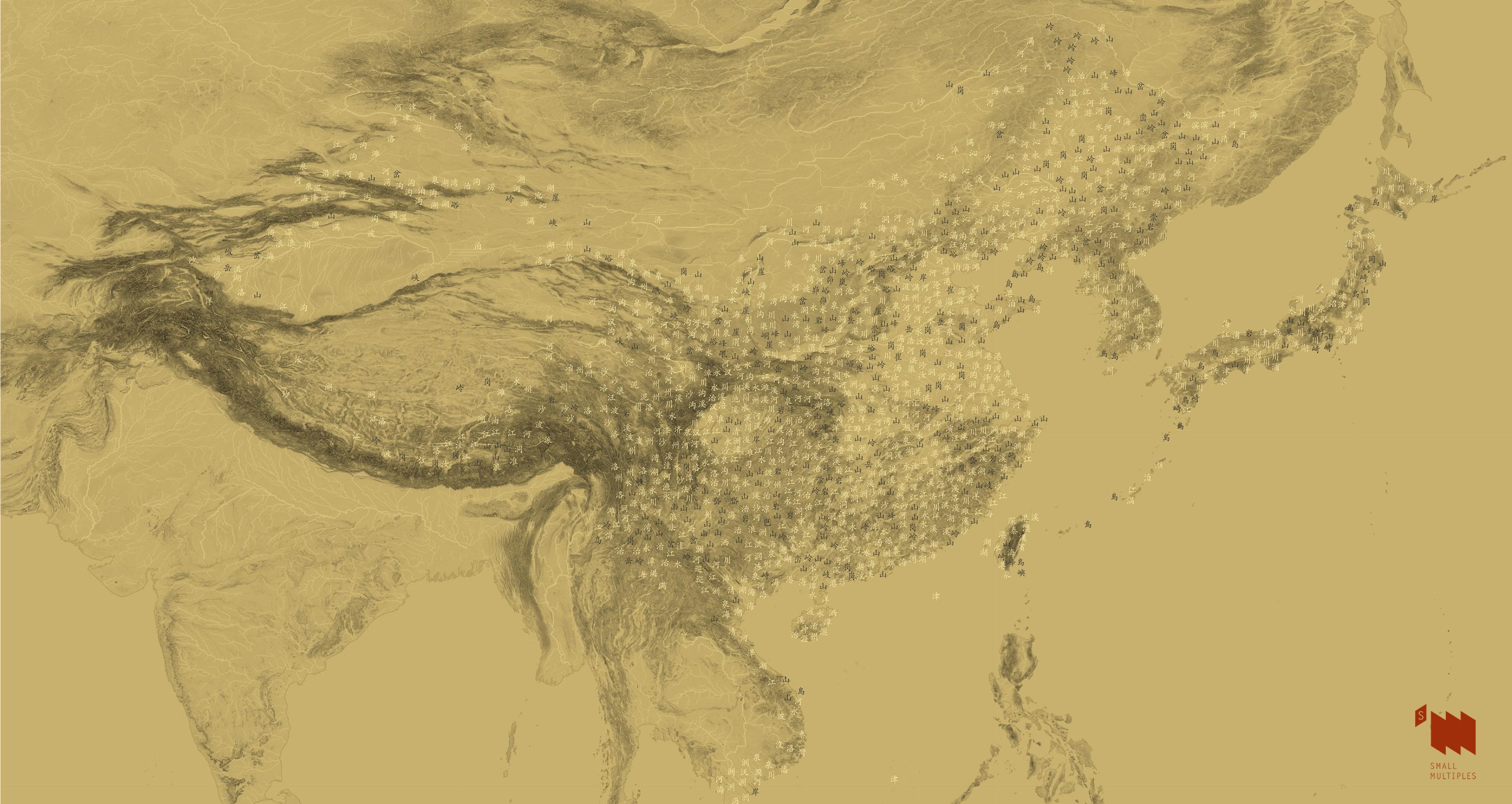
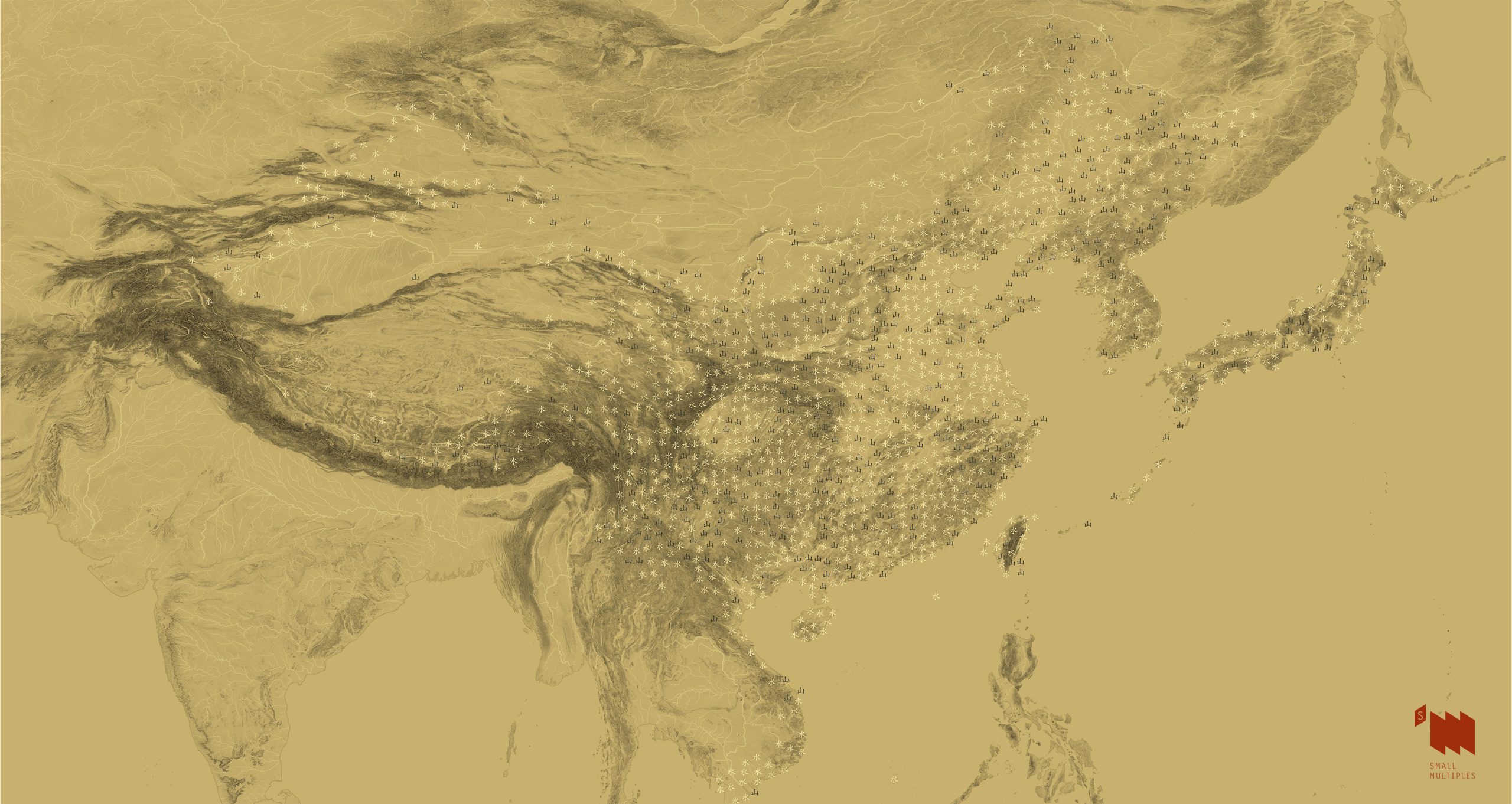
We made these maps to show:
- How often do mountain and river radicals appear in place names (counties, towns and villages) in the East-Asian cultural sphere?
- Does the use of these mountain and river associated characters reflect the local geography (mountainous or waterside)?
- Are there any differences in conventions between the cultures? e.g. Are some characters more frequently used for Japanese places than Chinese ones?
How the maps were made
- Place names (at county, town, and village levels) and their locations were extracted from GADM
- Google Translate was used to convert place names to Chinese characters when the they are not found in the data (North Korea and Vietnam)
- Identified place names that has at least one Chinese character containing mountain (山) or water (氵, 川) radical
- Labelled each place on the map with the matching Chinese character or with the radical type.
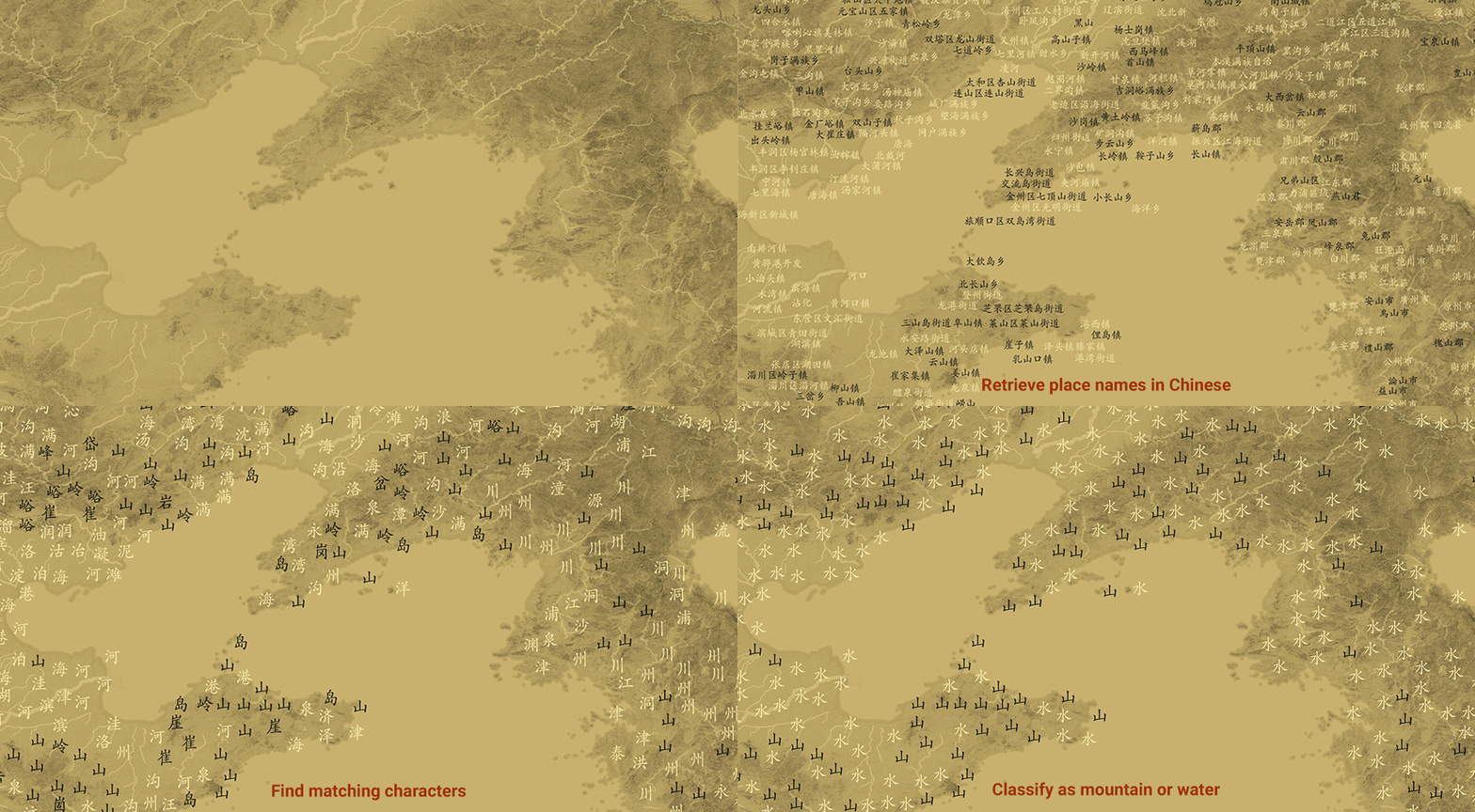
Characters that contain mountain or river radical
Interactive mapPlace names reduced to mountain or river radicals
Interactive mapCharacters and radicals
Highlights
Click to view full-size image
The North China Plain (华北平原)
The area on the lower reaches of the Yellow River is the largest alluvial plain of China, it formed the cradle of Chinese civilisation. Mountainous names appear to overlap with the major mountain ranges that surround the plain from the north (Yanshan), west (Taihang) and south (Dabie and Tianmu).
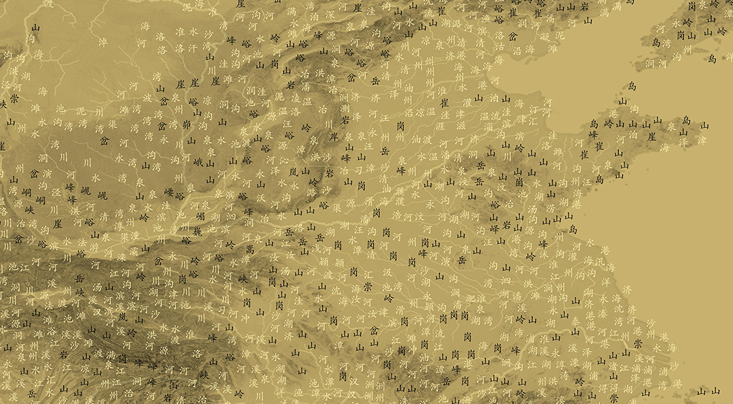
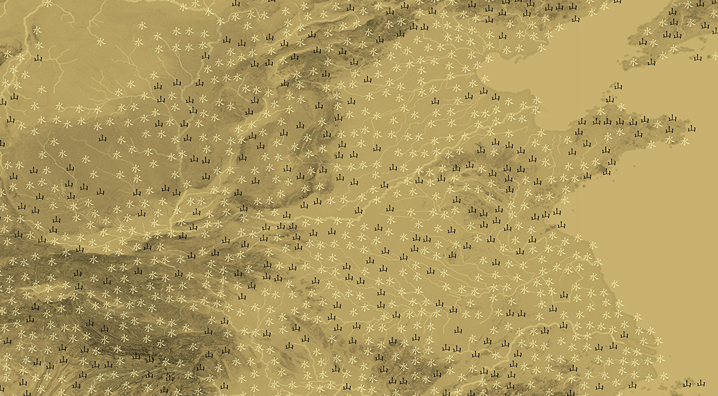
East Asia
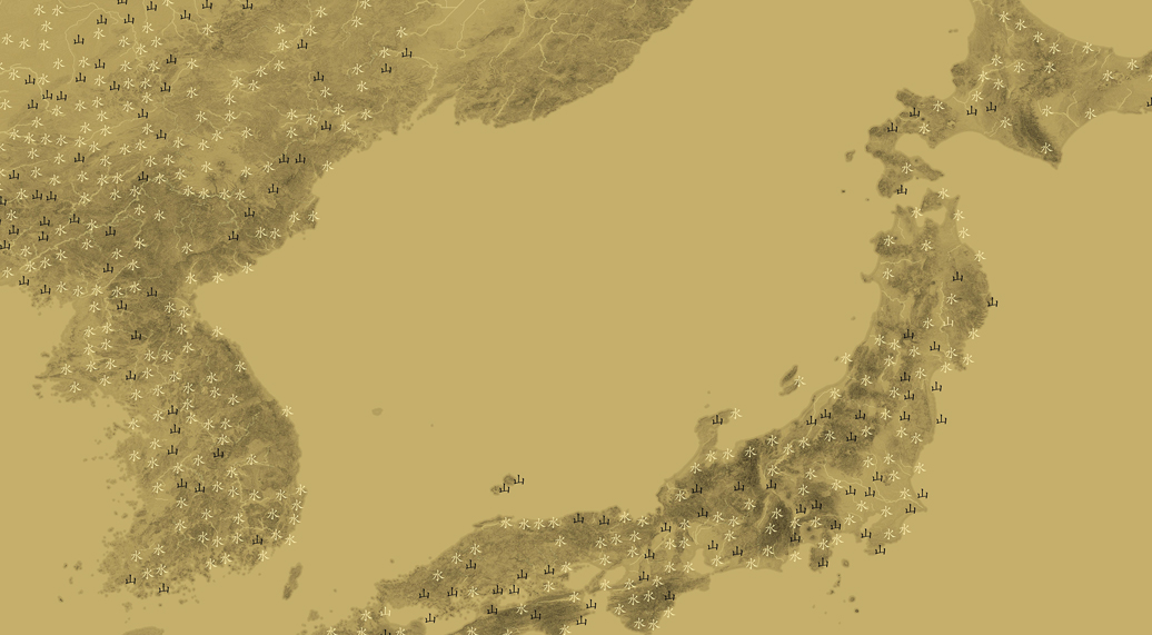
The abundance of mountainous names and pockets of water-associated names reflect the fact that about 73% of Japan is mountainous and most rivers are less than 300km. Also, if you think about it, islands are just mountains in the sea (as the character 島 illustrates).
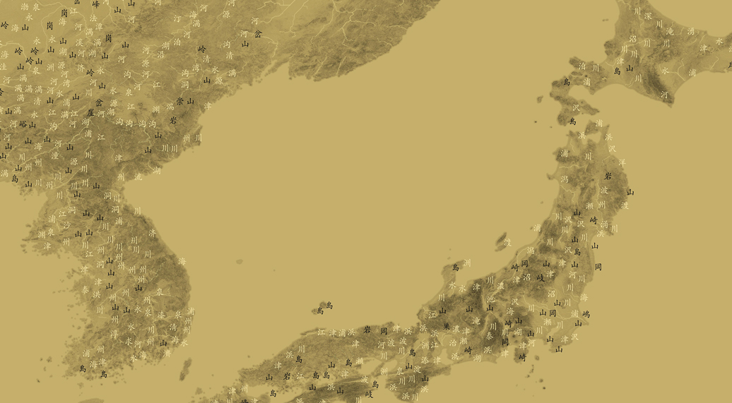
East-Asian Cultural Sphere
Data and tools
- Cjklib for Chinese character analysis
- QGIS for map creation
- EarthExplore / The Global Multi-resolution Terrain Elevation Data for digital elevation model (DEM) data
- GADM for place names and locations
Want to see more amazing maps? Check out Speaking Dutch in Darwin before Captain Cook, Business Empires in Australia, Aboriginal historical sites and mines in Western Australia, and more.


