A sacred site in Western Australia that showed 46,000 years of continual occupation and provided a 4,000-year-old genetic link to present-day traditional owners has been destroyed in the expansion of an iron ore mine.
Rio Tinto blasts 46,000-year-old Aboriginal site to expand iron ore mine, The Guardian, 26 May 2020
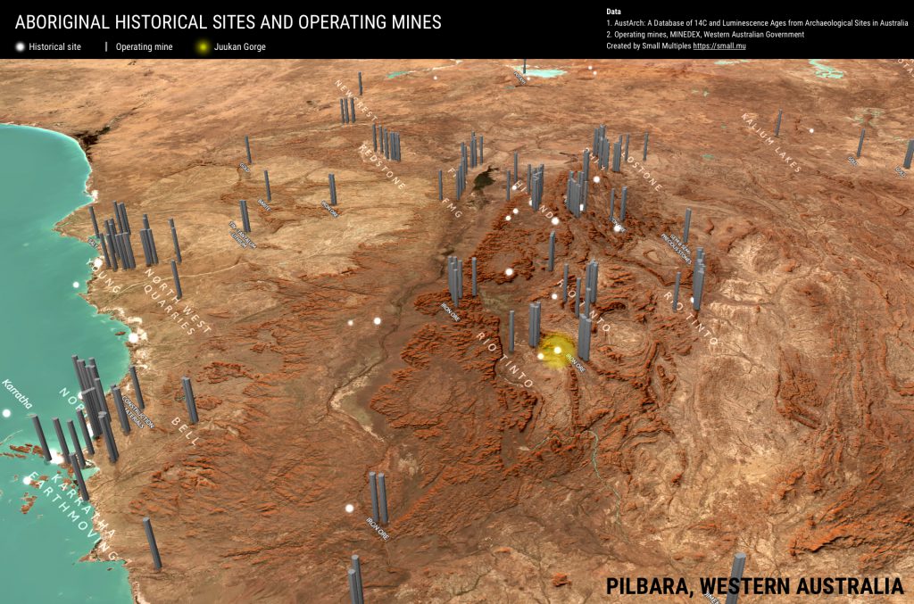
Two Aboriginal heritage sites in the Juukan Gorge were destroyed on 24 May 2020 by mining company Rio Tinto.
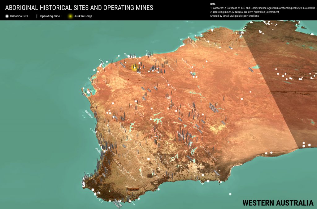
Amidst the outrage in the media, there was a lack of clarity on where the incident took place. Searching for “Juukan Gorge” in Google Maps yielded no results – rendering the event an abstract concept that people will find difficult to relate to. So we mapped the over 5000 identified heritage sites (including Juukan Gorge) and mining operations in Western Australia. We hope this map can help raise awareness about protecting indigenous culture.
Interactive map
Data (accessed 12 Jun 2020)
- Historical sites: AustArch: A Database of 14C and Luminescence Ages from Archaeological Sites in Australia, Alan Williams, Sean Ulm, 2014
- Operating mines: MINEDEX, Department of Mines, Industry Regulation and Safety, Western Australian Government
- Satellite images, DEM and map data: Mapbox
Map images


